Amisfield Walled Garden

Amisfield Walled Garden lies on the outskirts of Haddington. It is part of an estate that was acquired by Francis Charteris in 1713. It had previously been New Mills Cloth Manufactory which had been acquired by Colonel James Stanfield in 1681 who built a mansion called Newmills House near where Haddington Golf Club is situated today. Francis Charteris renamed the estate to Amisfield in memory of his ancestral home near Dumfries. His grandson who became the 7th Earl of Wemyss, built a new mansion house of red Garvald stone which was started around 1755. Later it was extended, the park constructed and in 1783, the walled garden was built over eight acres of land and with walls up to 16 feet in height. When the family later moved out, the park was rented out from 1881. In the First World War the house was used as an officers’ mess and the grounds for training soldiers. The house developed dry rot and was derelict until a local builder, Richard Baillie who had built Herdmanflat hospital bought it, demolished it in 1928 and used the stone to build a hospital in Haddington and Preston Lodge School in Prestonpans. The park was sold to East Lothian Council in 1969 and it is now leased to the Amisfield Preservation Trust who have turned it into a working community garden, run by volunteers and allows visitors free of charge. There are circular buildings at each corner

and diagonal avenues with apples and other trees.

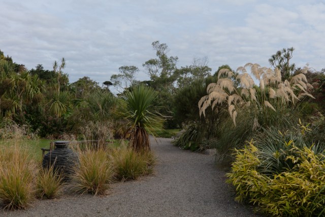
Around the edge are borders with flowers. In September it is mostly the late flowering ones

including Japanese Anemones

and Amaranthus caudatus also known as Love lies Bleeding.

There were pumpkins almost ready to harvest.

The volunteers have a greenhouse and polytunnel which they use to grow fruit and vegetables to sell.

Some old gates gave a view to other derelict buildings in the park.

We wandered around, enjoying the flowers and had a chat with some of the volunteers who were juicing apples. There is a cafe supplying drinks and cakes but we continued to enjoy the flowers before it was time to leave.

On the way out was a tree laden with berries. It will certainly be worth returning in different seasons.

Round Britain: Seward & Kirkcudbright

Early evening on the day before we left Seaward I got my telephoto lens out and took a photo of Little Ross Island and its lighthouse.

Heavy rain woke us during the night but there was a lull to allow us to pack up and leave. Our first stop was Kirkcudbright which we had last visited in 2017. Apparently in 1931 Dorothy L Sayers referred to it in her book Three Red Herrings as ‘Colourful heritage, cobbled streets and eighteenth century boulevards make the artists town on the banks of the River Dee a great weekend break’. We parked near St Cuthbert’s Church which was built in 1838.

A much earlier church said to have been established in the 7th century was situated to the east of the town and other buildings used until the population grew and St Cuthbert’s was built. I had a wander down to the harbour on the banks of the River Dee

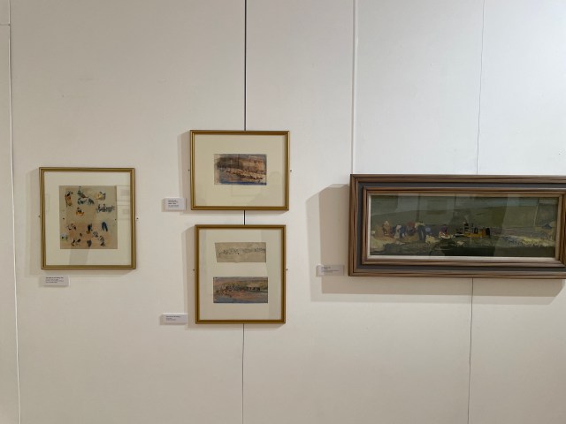
and then we found a coffee before visiting the Galleries in the old town hall. The exhibition I particularly wanted to see was Eardley Explored: the Art of Joan Eardley with photography by Audrey Walker. Audrey Walker was a friend of Joan Eardley. The ground floor contains works by artists who worked in and around Kirkcudbright including John Faed, EA Hornel, Jessie M King, Charles Oppenheimer, Robert Sivell and Phyllis Bone. The collection included paintings, drawings, illustrations, book covers and ceramics. Here are a few of the paintings.

MacLellan’s Castle also sits in the town and was built in the late 16th century.

Greyfriars Episcopal Church featured in the 1973 horror movie The Wicker Man. Leaving Kirkcudbright on the A711, we passed through Mutehill and then passed a large MOD range. The next stop was Dundrennan Abbey which is under the care of Historic Scotland but like many of their buildings is not completely accessible inside due to delays in assessing and dealing with problems during the pandemic.

Continuing we passed through Auchencairn and Polnackie before crossing a bridge to Dalbeattie. It has a large modern ‘learning campus’ which contains a nursery, primary and secondary schools. The Solway Coastal route passed through Barnbarroh, Colvend, Sandyhills, Mersehead Sands and Kirkbean. We stopped for lunch at a viewpoint near Drumburn but there was not much of a view.

Torrential rain began again and was forecast to continue for the next 48 hours. There was already a lot of water on the roads and flooding was obviously a risk. We had planned to continue our journey round the Solway coast but decided to return home a little early.                            

Round Britain: Garlieston to Seaward

After leaving Garlieston we drove southward on a B road down to the Isle of Whithorn.

The ruins of St Ninians Chapel sits  on the slope above the harbour. St Ninian was a missionary to the Picts in southern Scotland. The first chapel built here was in the 1100s to provide for the local people and to serve the pilgrims who were on their way to Whithorn Priory. The current remains were rebuilt around 1300 and were repaired in 1898 by the Marquess of Bute.

On the headland beyond the chapel is the cairn: a white tower which has been used as a navigation aid for several hundred years and in World War 2 was a tracking station for anti-aircraft gunnery practice.

There is also memorial to the Solway Harvester and its crew which sunk in 2000.

Back down near the chapel is a memorial for dogs that people can add stones to if they wish.

St Ninian’s Cave is down on the shoreline further along the coast. The 1973 film Wicker Man was filmed near there. We continued on past Whithorn and on to Wigtown, crossing the River Bladnoch where the distillery sits, before entering the main street. We had last visited it in 2017. Wigtown was designated as Scotland’s Book Town in 1998 and now has several bookshops including the largest in Scotland.

They are celebrating their 25th Anniversary with a Book Festival from 22 September to 1 October 2023. Some shops were not open today, including the Byre Books

but we did appreciate one local person’s efforts to fill as many wellingtons as possible with flowers.

After coffee in one of the local cafes we drove north past Newton Stewart and the head of Wigtown Bay where the River Cree enters the bay then down the east shore. The old military road diverts round Creetown and just after that is a parking space on the shore where we had our lunch. Wigtown Bay also has a Nature Reserve. Towards the end of the parking area was a large granite stone. It stated that Creetown granite had been quarried nearby and used to build Liverpool Docks and also the clock tower in Creetown.

After lunch we continued past the ruined Carsluith Castle, up Loch Fleet, past Skyreburn Bay, Gatehouse of Fleet and just before Kirkcudbright, turned down the east side of the River Dee which enters the bay and down to Seaward where we settled into the campsite. There are views over the bay

and in the distance is Little Ross Island with a lighthouse. Below the road is a beach which I had a wander on and found some sea glass.

Round Britain: Portpatrick to Garlieston

I watched the sun go down behind Dunskey Castle at the end of our day there.

We left Castlebay the next day on a bright but cool morning. From Portpatrick we drove over to the west side of Luce Bay and then south past Sandhead, New England Bay and Drummore (which has Scotland’s most southern store) before we reached the Mull of Galloway, the southern most point of Scotland. It has been owned by the Mull of Galloway Community Trust since 2013, has had an RSPB Reserve since 1975 and is also a Site of Special Scientific Interest. The Ordnance Survey map indicated that Luce Bay was an MOD Bombing Range. The lighthouse was built by Robert Stevenson in 1830.

There are views to nearby cliffs

and over the sea.

There was a photographic exhibition in the lighthouse grounds

and a signpost indicating the distance to various towns and cities.

Cattle were grazing in the nearby fields.

After wandering around for a while, we headed back up the peninsula to the Logan Botanic Garden. The almost sub-tropical climate here, assisted by the Gulf Stream has led it to focus on plants from countries in the southern hemisphere, South America, Australia, New Zealand and Southern Africa. On arrival some of the first plants we saw were palm trees

and we then entered the walled garden.

After coffee some we passed the Gunnera Bog,

a pond,

 a large Eucalyptus

and a coloured tree called Acacia baileyana.

The conservatory has a great collection of succulents and others.

Afterwards it was time to head north again past Ardwell and Sandhead and then rounding the head of Luce Bay. We saw a sign saying there was an MOD Soft Target Station. On the A747 down the east side of the bay we passed a couple of quarries and a wind farm before the road returned to the coast. Our lunch stop was on a beach with many pebbles.

Continuing past Port William, the road then turns inland. We passed a building which said it was the Galloway Astronomy Centre before reaching Whithorn and then our campsite at Garlieston Bay.

Garlieston was a planned village constructed in the 18th century by Lord Garlies who later became the 6th Earl of Galloway. Not long after we arrived it started to rain and was due to continue for the rest of the evening so no more exploration until the next day.

Round Britain: Culzean to Portpatrick

On our last night at Culzean I watched the sun go down.

The following day was dry and sunny. We set off southbound on the A719 which passes Maidens and Turnberry where in addition to all the golf courses and associated buildings, there are abandoned airport runways. We then rejoined the A77 and drove on down a very familiar road which we take whenever we are travelling to visit James’s parents in Northern Ireland. Just past Girvan there are views over to the Ailsa Craig.

Since the mid-19th century, the microgranite from the island has been used to make stones for the sport of curling. Apparently the only other source is from a quarry in Wales. Further on we passed Lendalfoot which sits where the River Lendal reaches the sea. Past Ballantrae the road crosses the River Stinchar and heads inland. After Smyrton and through Glen App it then descends to the coast again and we entered Dumfries and Galloway. Cairnryan was a World War 2 military port handling supplies of food and ammunition from the USA but is now the main port for ferries crossing to Belfast. In Stranraer we picked up supplies and topped up the caffeine levels. On the shore of Loch Ryan is Stranraer west beach where we parked for a while and had our lunch.

Afterwards we continued the short distance to our next stop at Castle Bay next  to Port Patrick. Our campsite overlooks Dunskey Castle, a 12th Building which has been ruined since 1700 and is currently in private hands.

It was used as a location for the 1951 film of Robert Louis Stevenson’s novel Kidnapped and others. It is accessible by a coastal path and one from the campsite but there is no access to the interior. I had a wander around the outside.

Late afternoon we walked along the coastal path from the campsite to Portpatrick.

It enters the town near the beach

and we continued our walk around the harbour. Scotland’s first charitable Community Benefit Society ‘Portpatrick Harbour CBS’ was formed in 2015 to secure it in community ownership. There is a life boat station first built in 1877 after a large number of ship wrecks had happened.

The Southern Upland Way starts here. After our wander around town, we had a meal in one of the local hostelries. The owner said that business had still not returned to what it was before the pandemic.

Round Britain: Luss to Culzean

On a quiet dull morning in Luss, several mallard ducks appeared at the site just before we set off southbound on the old military road through the village to rejoin the A82. The road crossed the border into West Dunbartonshire before crossing the Erskine Bridge over the River Clyde. The A8 continues along the south bank of the Clyde past Langbank and then through Port Glasgow and to Greenock where we took the A770 to Gourock stopping for coffee and enjoying the views over the water.

Gourock was a port before Greenock was and has the Kempock Stone which I didn’t see but is surrounded by superstitions. It is said that sailors would march around it with baskets of sand chanting incantations for safe voyages. Continuing we passed the Cloch Lighthouse and Lunderston Bay before rejoining the A78. The road passes Inverkip, Wemyss Bay and parallels the railway line. We saw the ferry to Rothesay and entered North Ayrshire near Skelmorlie where the sun came out. Largs had a fair taking place on the shore. We passed Hunterston Nuclear Power Stations.  A closed in 1990 and B in 2022. The decommission processes are ongoing. After West Kilbride we passed Adrosssan, Saltcoats and Irvine. After Prestwick Airport the A719 coastal route ran through the town where people were coming out of the churches. We crossed the River Ayr before heading through the town where an Air show was taking place on the shore. Over the River Doon and past Dunure which has a ruined castle, we saw the Ailsa Craig for the first time on this trip. Shortly afterwards we arrived at the campsite at Culzean which has views over the sea to Arran although rather hazy at the moment.

The following morning, we walked from the site down to Culzean Castle and Country Park. Fallen leaves by the side of the road made it look rather autumnal.

The Home Farm is now the visitor centre with a café and gift shop.

In the nearby Gas House was a small collection of bath chairs and a small carriage.

Culzean Castle was originally called Coif or Cove Castle and belonged to the Kennedy family for several hundred years. The original building was defensive and military but in the 18th century it began to be converted into its current state involving the architect Robert Adam. It has belonged to the National Trust for Scotland since 1945. After walking through the woods, we entered through the ‘ruined arch’.

You can join a guided tour around the interior or as we did, just wander around by yourselves. There are information sheets in several languages in each room.

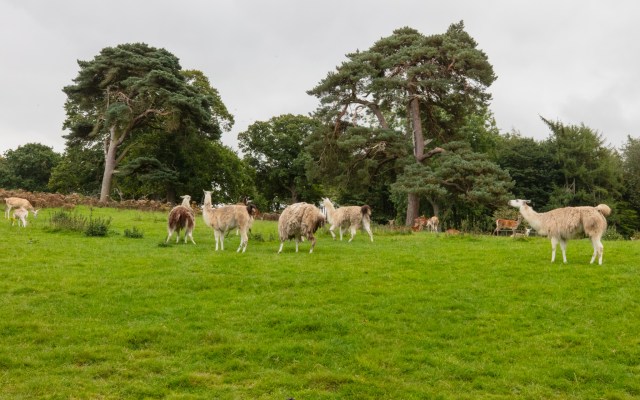
Afterwards we visited the secondhand bookshop and then the deer park. It has been at Culzean since the 1750s and now has red and fallow deer and llamas.

There are lots of other things to see in the park but we decided to return to the site for lunch and relaxation.

Round Britain: Glendaruel to Luss

Waking to a very cloudy morning we left the campsite and headed south on the A886 through Glendaruel. Kilmodan Church was named after Saint Modan, an early saint associated with the area.

A collection of medieval carved stones are housed in a small building in the churchyard.

Further on, we turned onto the B836 which runs around the head of Loch Scriven before passing the Tarsan Dam. It then continues down Glen Lean to Clachaig and then joins the road down to Dunoon. A ferry runs from here to Gourock.

There is an old building on the pier

and hazy views over the water.

Returning north along the coast we came to Holy Loch and Lazaretto Point, a war memorial.

Heading north, the A815 enters the Loch Lomond and the Trossachs National Park. We then stopped at Benmore Botanic Garden which is one of the gardens run by the Royal Botanic Garden of Edinburgh. Close to the entrance are giant redwoods.

A little further on is an avenue of them which is currently closed while work is going to revitalise the soil.

We saw a red squirrel but it disappeared before I could get my telephoto lens out. The squirrel observatory and the Fernery do not open until 11am despite the garden opening at 10am. We walked around some of the garden.

At this time of year there are few flowers

but we did see some fungi

and lots of lichen.

The estate was gifted to the Royal Botanic Garden of Edinburgh in 1928 and became its first regional garden having previously been owned by a Greenock sugar magnate and then an Edinburgh brewer. The Golden Gates were the entrance to Benmore House which is now an Outward Bound Centre. They were exhibited at the Paris Exhibition in 1878 and were restored in recent years.

There is a pond

and many other areas that we did not have time to explore on this occasion. After grabbing a coffee at the café, we continued north along the east side of Loch Eck which had several warning signs along the road telling drivers to look out for swans on the road. We only saw several pheasants. At Strachur we returned to Loch Fyne and carried on the A83 and A82 to our next campsite at Luss which sits on the west side of Loch Lomond. Today the summit of Ben Lomond was hidden by clouds.

Luss is a conservation village. Occupation of the village dates back to medieval times, but much of what you see today was created in the 18th and 19th centuries to house workers from the nearby slate quarries. St Kessog, an Irish missionary, arrived around 1,500 years ago. At this time Luss was called Clachan Dhu (the dark village). He was martyred and his body embalmed with sweet herbs. Legends claim that sweet herbs grew over his grave. Lus is Gaelic for herb so that is suggested as how the village got its name. The current church was built in 1875 but the graveyard is much older, the earliest stones dating from the 7th or 8th century. We could not look around much on the day we arrived as there were several events going on so we settled into the van for a quiet afternoon.

Round Britain: Machrihanish to Glendaruel

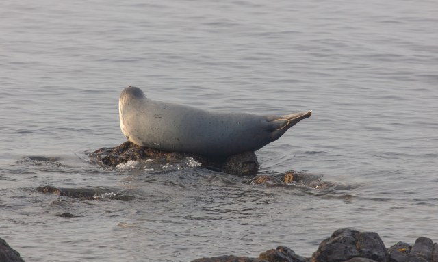
Our last evening in Machrihanish arrived with a thunderstorm after two warm and sunny days. We got our waterproofs out and walked to a local hostelry for our evening meal. I was glad to have seen the sunset the previous evening. On a dry, warm morning we first drove down to the southern part of the Mull of Kintyre on the B842. It runs through farmland and forests to Southend and Dunaverty Bay. There was a seal resting on a rock. There were several oystercatchers on the beach and one heron on a rock further out who flew off before I could get a photograph.

We returned to Campbeltown to pick up some supplies and continued on the B842 on the northern side of Campbeltown Loch. The road passes through Peninver and Ardnacross Bay before reaching Saddell Bay which is said to be where Paul McCartney’s Mull of Kintyre video was filmed. Across the other side of the water towards Portvadie is where Polphail Village was flattened in 2016 when it was only 40 years old. The village was built to accommodate 500 workers for a nearby oil platform construction yard but it was never occupied and remained a ghost town from the day it was completed to the day it was bulldozed. It is said to have provided a home to a colony of bats and a blank canvas for street artists. We made a short diversion down a side road to Carradale Bay where we hoped to find a coffee. The harbour was quiet

and the tea room was closed. We had to continue past Grogport and Claonaig before arriving in Tarbert to top up the caffeine levels.

We were then back on the A83 which like many roads in this part of Scotland is lined with rhododendrons, crocosmia and bamboo: all non-native garden escapes from the estates that brought these plants into the country in the late 18th and 19th centuries.  The road continues through Lochgilphead and Inverary, passing the Loch Fyne Oyster Bar which we ate in many years ago during a holiday with some friends. After Cairndow we took the A815 and then the A886 heading south on the Cowal Peninsula to Glendaruel. The River Ruel runs down to the Kyles of Bute. The campsite we stayed at for one night is on the site of Glendaruel House. In the Second World war it was requisitioned and used as a hospital. Afterwards it was sold, used as a hotel and then destroyed by a fire in 1970. The population of the village is now less than 200 and it has lost a lot of its services including a post office, tea room, hotel and general store. The campsite is quiet and surrounded by woodland which provides some welcome shade in the hot weather.

Round Britain: Lochgilphead to Machrihanish

En route to Lochgilphead where we were re-starting our tour of the British coast we passed Glasgow and stopped briefly so that I could take a photograph of the Clydeside Distillery which has been there since 1897.

I am compiling a photobook for James of the whisky distilleries in the British Isles. There were views over the Clyde on a very sunny morning

and street art on the nearby railway bridge.

Continuing, we stopped for lunch at the Rest and be Thankful. These words were inscribed on a stone by the workers who built the military road in the 1740s. There is a good view down the glen.

After settling into the campsite, it was time to walk to a local restaurant for a meal. There are views down Loch Gilp from the shore.

The following morning we set off down the west side of Loch Gilp. The road parallels the southern end of the Crinan Canal and passes through Ardrishaig. A little further on we took the B8204 which runs over a hill, past a small lochan and down to Loch Caolisport. There are several small villages along the road. At Achahoish was a firewood seller and at Ormisary there was a fish farm. There are views over to Jura and Islay. At Kilberry there are some engraved stones which may have come from a medieval church and burial ground nearby.

While a drain was being dug under a bowling green, human bones were found. The stones are dated between the 14th and 15th centuries. There is also the remains of a castle nearby but it is on private land with no access. At Tarbet we entered the Mull of Kintyre which I had not visited since childhood. In 1597 Kintyre had been marked out as a rebellious part of the Gaelic west which needed control. Ten years later Clan Donald lands were taken over by Archibald Campbell, Earl of Argyll. Hence the town he created became Campbeltown. The plantation by the lowland lairds happened in 1650, most came from Ayrshire and Renfrewshire and took place before the plantation of Ulster. We had a coffee in Tarbert and then walked up the hill from the harbour to the ruined castle.

There was a hill fort here which became a Royal Castle in 1292. It was extended by Robert the Bruce in 1325 and repaired further by James IV in 1494. IN 1705 it was tenanted by the Campbells but fell into disrepair by 1760 when most of the useful stones were used to build the harbour. There are views all around from the castle.

We then continued down the A83 along the side of West Loch Tarbert, passing Kennacraig where the ferry to Islay departs from and further on, the Arran Ferry port. Lunch was had in a small car park just south of Ronachan Bay. Apparently seals and otters can be seen here but none on my visit. There are views over to Gigha and Jura.

At Tayinloan a ferry runs to Gigha. After Campbeltown airport we drove through the town and then took the B road to Machrihanish. The town was formerly known as ‘The Pans’ up to the 18th century when salt was formed from the evaporation of seawater and it is still on this old milepost.

Kintyre’s only mine closed in 1967 and was nearby. Our campsite was next to the golf course but there were views over to the sea so in the evening I watched the sun go down.

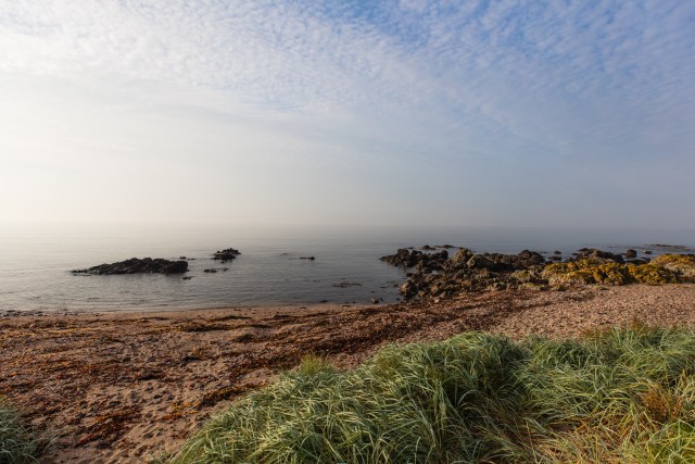
The following morning was time for a beach walk. Machrihanish Bay is a Site of Special Scientific Interest (SSSI) and has the largest sand dune system in mainland Argyll.  It was very quiet that morning.

A lazy day followed before we got ready for the next leg in our journey.

Glenarm Gardens to Torr Head

While in Northern Ireland to visit James’s parents we took some time out to explore a little of the nearby coast. Glenarm Castle has quite a traumatic history. The McDonnells came to Glenarm from Scotland in the late 14th Century when John Mor MacDonnell married Marjory Bisset, who was heiress to the Glens of Antrim. They first built Dunluce Castle and then Glenarm. The first castle was situated where Glenarm village is now. The one on the present site was built in 1636 by Randal MacDonnell, 1st Earl of Antrim in 1636. Six years later it was burned by a Scots Covenanter army who were attacking the Royalist McDonnells.  It remained ruined for 90 years. The Antrim estate covered 330,000 acres of the county and the family built a wing onto the ruin to live in when they were visiting. In 1756 it was rebuilt along with the lime tree avenue and the gardens. In 1813 other changes were made including a Barbican gatehouse. In 1929 a fire devastated the main block and the following reconstruction was not thought to be very good, having lost some of the original features. The 13th Earl of Antrim married a professional sculptor in 1939 and she added sculptures and decorations. Another fire in 1967 destroyed a wing but the old kitchen survived as the only room in continuous use since the 18th century. The garden opened to the public in 2005 after restoration. The castle remains private and hidden by trees from the garden. As it was coffee time we stopped for one at the tea room which is in what was the old mushroom house. On our exploration of the gardens, we first passed the Potting Shed which is a cafe with outdoor seating and a stage.    

The first part of the garden was the vegetable garden which had a wall covered with fig trees.  

We then wandered around the 4 acre walled garden which was built in the 1820s.    

There are several sculptures including this one  

and a woodland walk behind.

Closer to the entrance are several shops and a mini Landrover riding field for children. Current businesses on site are an organic salmon farm, organic shorthorn beef herd, farming and hydroelectric enterprises. On leaving Glenarm we headed down to the coast road where there are views over the bay and harbour.

We then continued northwards through Carnlough and stopped for lunch on the Garron Road.

The coast road was constructed to provide relief work during the Great Famine of 1845-1848. Many abandoned cottages are left after the mass emigration. After the plantation: tenant farming families had very small portions of land, barely enough to sustain them and the famine finally finished their time here. At Cushendall we had a wander along the beach

and the harbour  

where Mallard ducks were sleeping  

before an ice cream at the Corner House Inn. We noticed that many of the hedges in the area are made of fuchsia, a South American plant. It provides shelter for livestock and some insects including the Elephant Hawk Moth feed on it. Heading towards Torr Head, we stopped at Coolranny which overlooks Loughan Bay.

The  woodland gorges and hills are owned by the National Trust and there are views over to Kintyre 12 miles away; Sanda Island and Ailsa Craig. We will be in Kintyre and closer to the islands in September on our next van trip. Torr Head has a Coast Guard station built in 1822 which was a signal station for shipping.

In addition to some street art  

you can climb to the top of the building for views all around.

The large, ruined building on the road side was accommodation for off-duty coast guards. The station was burnt down by the IRA in 1922 who thought the British forces might use it as a base and was then abandoned.